MEMPHIS, Tenn. — When you walk outside this week, you will be able to feel the moisture in the air. This is pretty typical during our warmer months as humidity increases thanks to the increase in moisture in our atmosphere. The amount of humidity you feel is something that could be changing though which is something we can potentially link to changes in our climate.
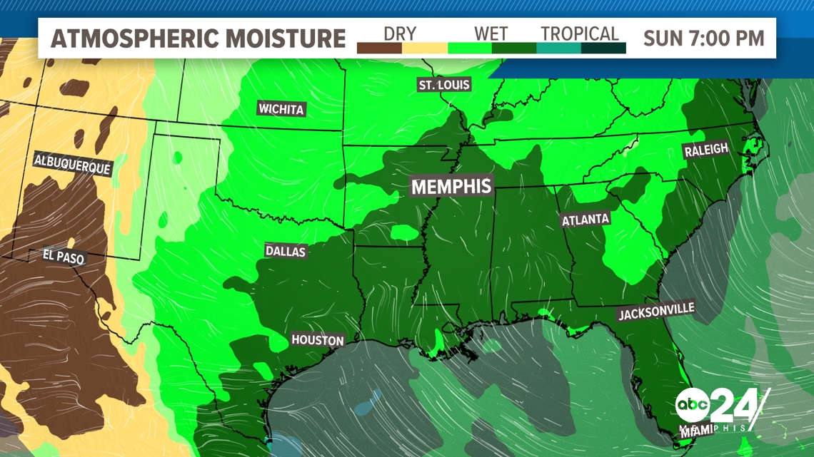
Looking at the weather this week ahead, a strong Bermuda High will be pulling moisture out of the Gulf of Mexico. While this setup is not out of the normal for this time of the year, it is bringing in higher amounts of moisture than we normally can expect this time of the year.


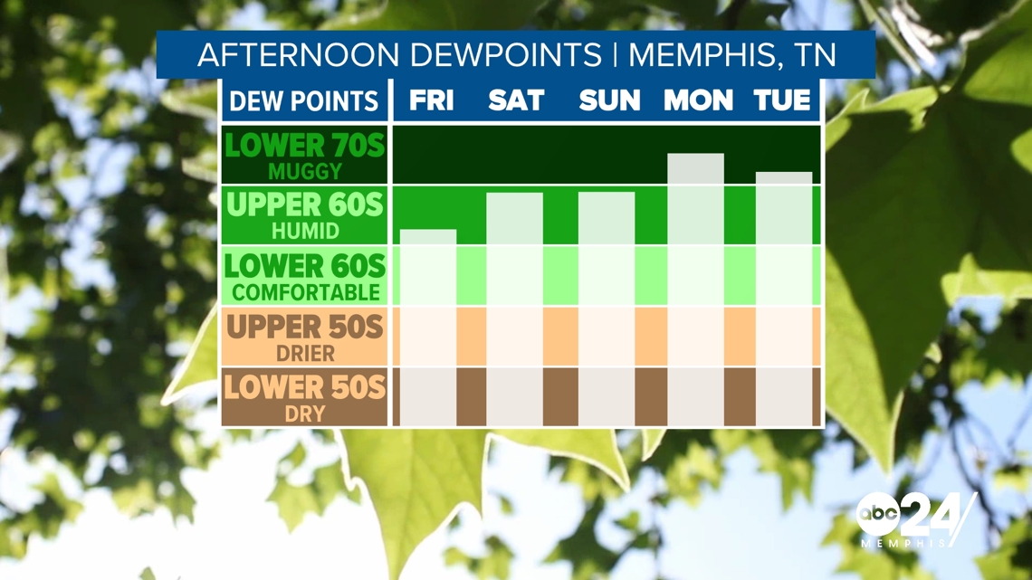
Dewpoints are forecast to be in the upper 60s and even lower 70s this week. That puts the air solidly into the muggy category. When it comes to dewpoints this time of the year, we typically can expect the middle 60s. That puts this week above average for the month of May.


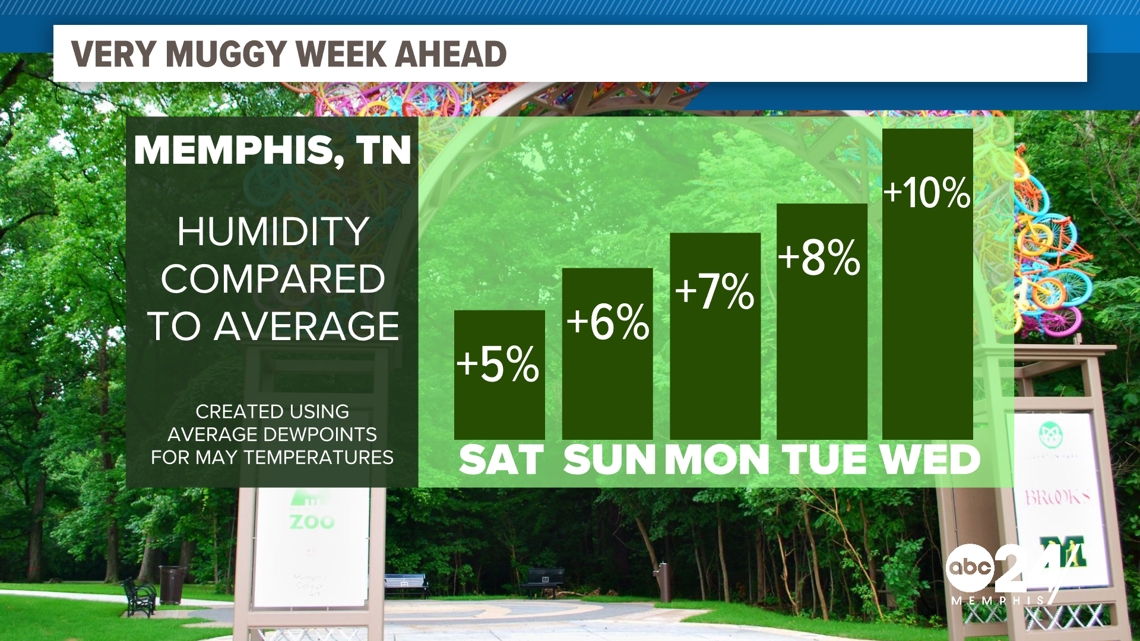
If we break down the numbers even more, we can see that this humidity that we are feeling over the next 5 days is anywhere from 5 to 10% "wetter" than what an average May day would be at considering the amount of warmth we have.


All of this moisture is going to lead to popup storm chances through the middle of next week. While this is normal given the setup, this could be part of a larger trend. As our atmosphere warms thanks to climate change, the air can hold more water. This leads to higher dewpoints but also more extreme rainfall events.


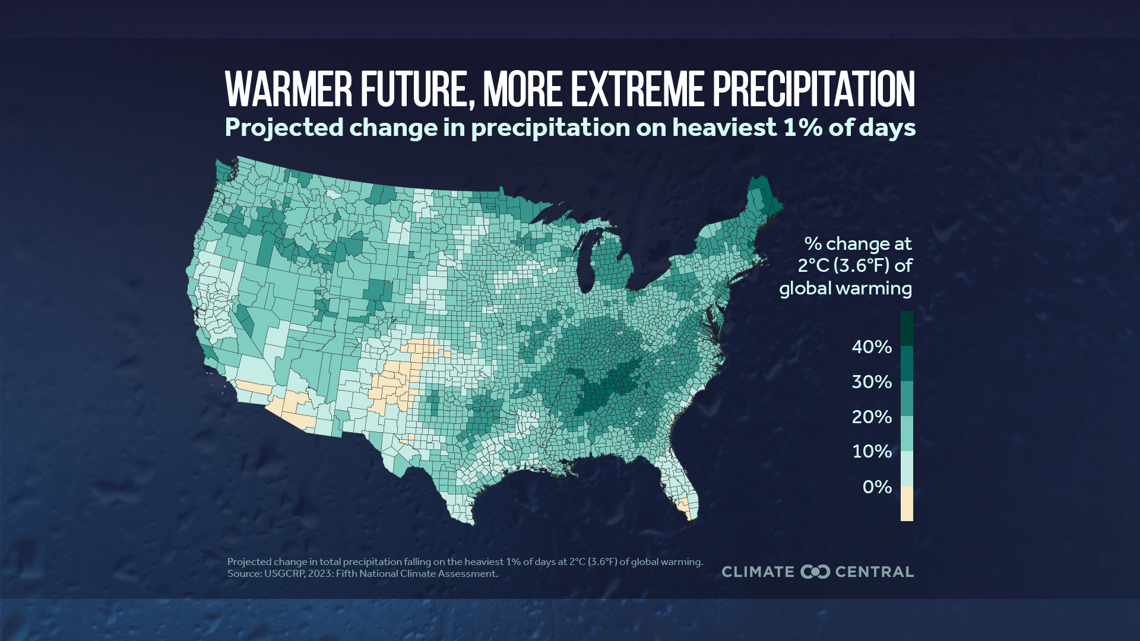
Our partners at Climate Central have mapped out what this change could look like when it comes to our heaviest rainfall events. We can expect an increase not only here in the Mid-South but also across much of the eastern United States when it comes to our rainest of days.


