
MEMPHIS, Tenn. — 2024 is heading into the most active stretch of weather we have seen in the Mid-South in the past few months. This will result in the chances of heavy rain, possible storms, wind and the coldest air of the season.
To simplify things, we will go from this weekend and talk through each weather system looking towards a week out from now.
MONDAY & TUESDAY

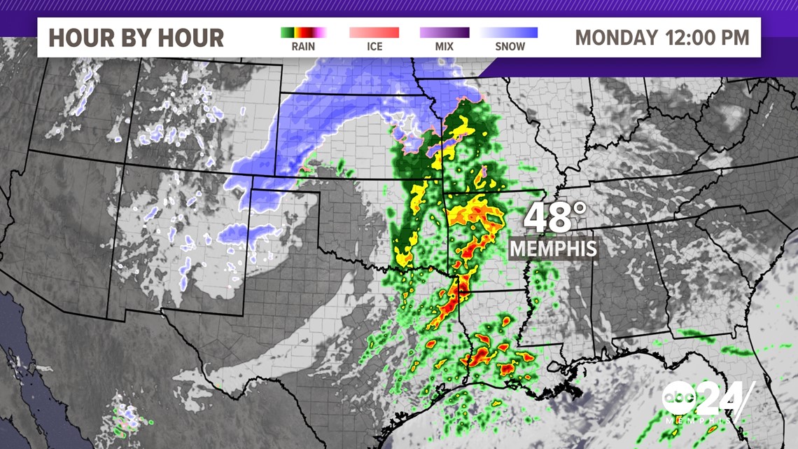
The theme for at least the next two weeks will be active and stormy. This will be the case as we watch our first system of this upcoming week form in the Southern Plains. This strong low-pressure system will cut to the Northeast quickly meaning winter weather is no concern.
We will be watching for both heavy rain and strong winds as this low pushes through the Mid-South.
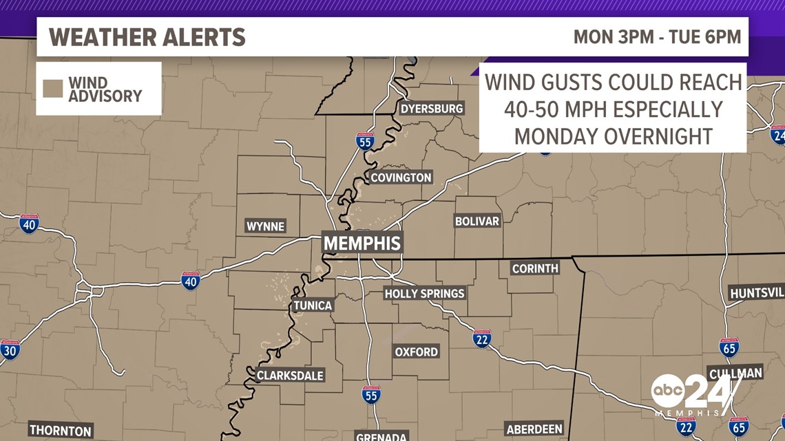
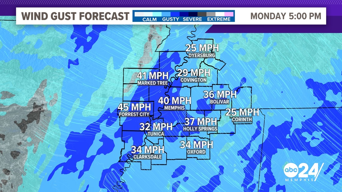
Ahead of the storm, a WIND ADVISORY has been issued for the Mid-South. This is due to 20-25 mph winds with gusts of 40-50mph being possible during the next two days.

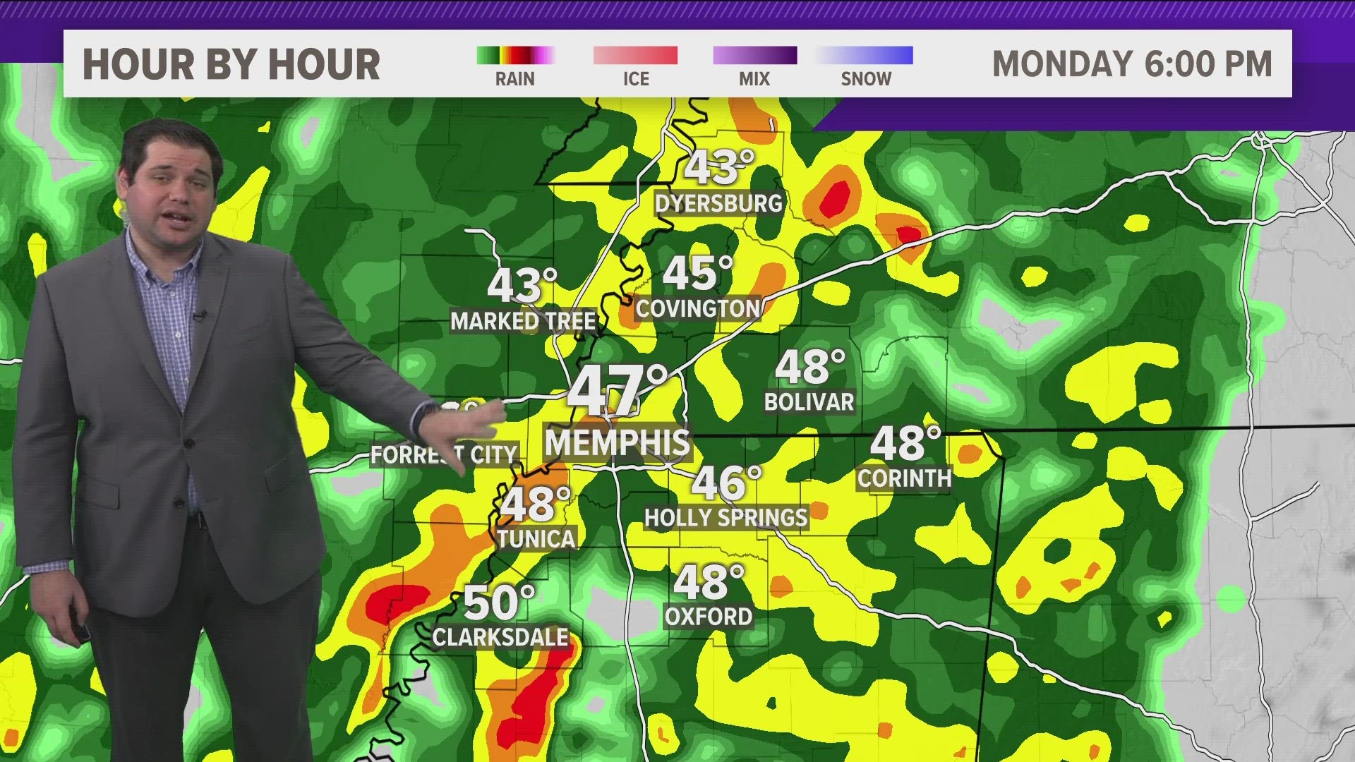
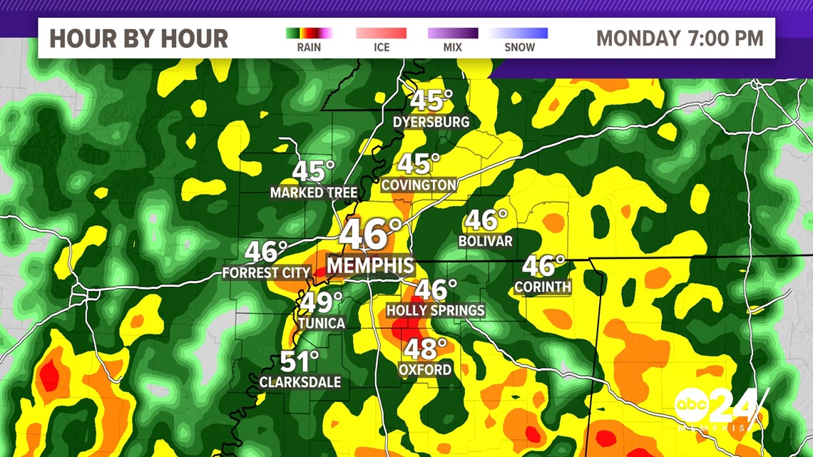
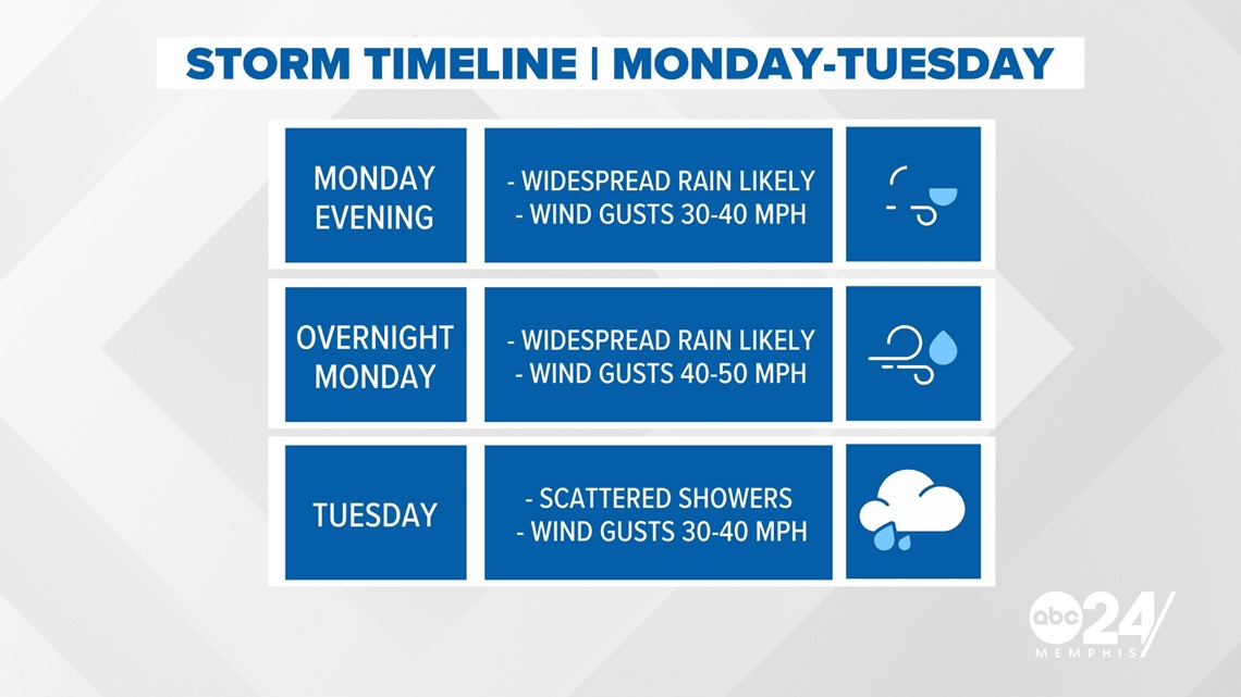
As of right now, scattered showers look to begin on Monday afternoon. At this point, winds will likely be gusting up to 20 to 30 mph. Rain will become much more widespread heading into the evening and this is when our winds look to really pick up as the cold front slowly marches to the east.

During the overnight hours models are pushing our wind gusts a bit higher. It would not be out of the question especially in the Eastern-most counties to see winds gusting to 50 mph. During this time we can't rule out an isolated power outage in the Mid-South due to downed trees.

Rain should end by about 10 a.m. on Tuesday morning and should leave at about 1-2 inches of rain for the storm. Even being dry past this point, the wrap-around wind will keep gusty conditions around into the afternoon with gusts of 20-30 mph expected.

FRIDAY & SATURDAY

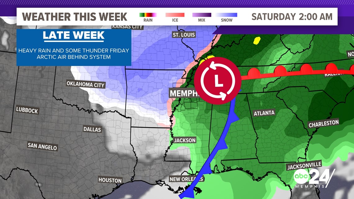
This part of the forecast so there is a lot that can change between now and then. With that being said, it looks like another strong system will usher in the coldest air we have seen so far this season.
Models currently are showing an area of low pressure entering the Mid-South on Friday. The exact track will really change what impacts we will see ranging from severe weather to even winter weather.
As of Saturday night, rain and windy conditions are at least on the table for the future forecast again. As the system exits the region, it looks like a frigid weekend will be on the way with highs in the 30s and wind making it feel like things are in the teens on Saturday.