MEMPHIS, Tenn. — Memphis and the Mid-South are well off the coast but that doesn't mean that we don's see impacts from tropical weather. That will be the case as the remnants of Tropical Storm Beryl moves farther into the southern US.
These storms often produce heavy rain along the core of the storm which will stay well outside of the Mid-South and is expected in Central Arkansas in Missouri. The bigger issue which will potentially impact Memphis is the threat of tornadic weather.


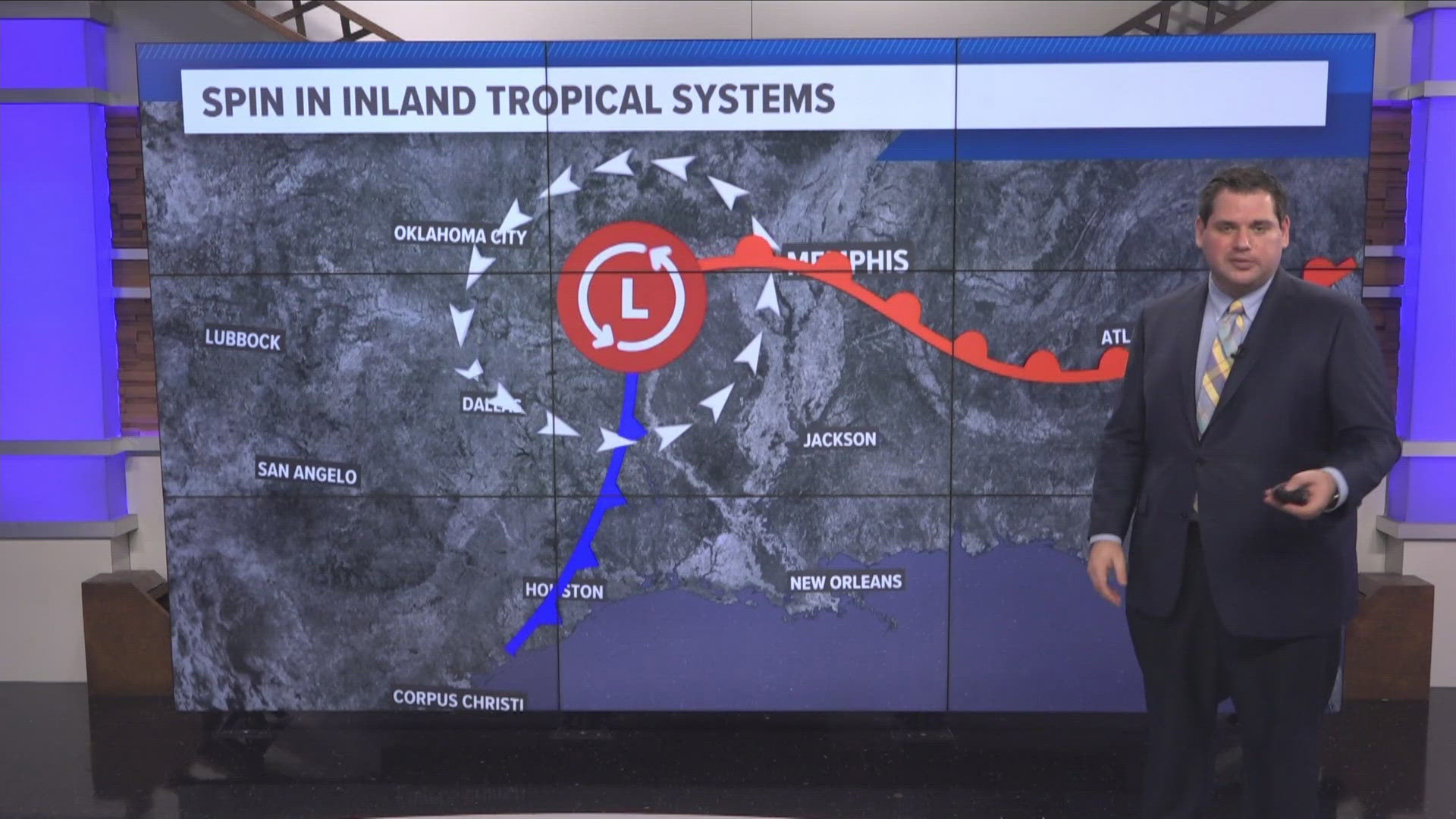
Tropical systems often have tornadoes on their eastern side at landfall. This is due to frictional forces as storms in feeder bands move from water to the coast. As these storms move much further inland the tornado threat begins to become more about wind direction. This will be the case in Memphis and the Mid-South on Monday night. Winds from the east and southeast at the surface will set the stage for spin in the atmosphere.


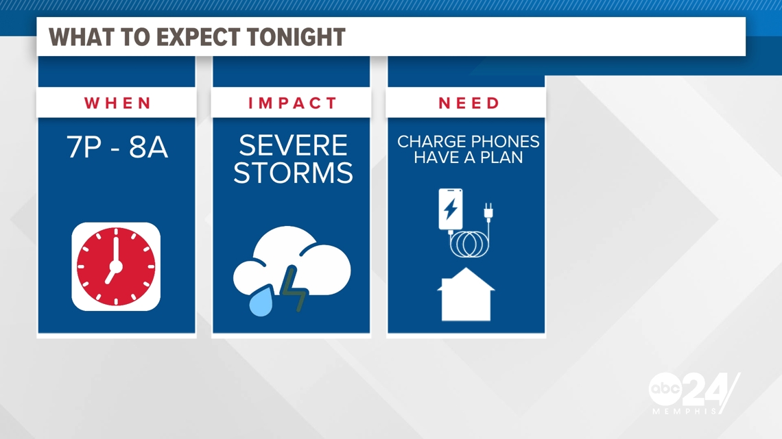
As of Monday evening, this spin is expected to be greatest in Arkansas where a slight risk of severe weather is issued by the Storm Prediction Center. This is where a few storms could potentially produce tornadic weather. The timing from these storms looks to be between 7PM on Monday through 8AM on Tuesday morning.
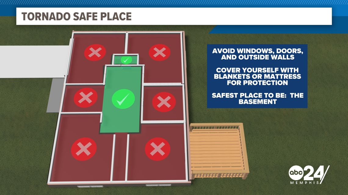
When it comes to severe weather, it is important to have a severe weather plan in place. Charging your phones and making sure you have a way to get severe warnings is important. This, along with making sure you have a safe place to shelter in case a tornado warning gets issued for where you live.