

MEMPHIS, Tenn. — Hurricane Helene made landfall Thursday night in northwestern Florida as a Category 4 storm as forecasters warned that the enormous system could create a “nightmare” storm surge and bring dangerous winds and rain across much of the southeastern U.S.
The National Hurricane Center in Miami said Helene roared ashore around 11:10 p.m. EDT near the mouth of the Aucilla River in the Big Bend area of Florida’s Gulf Coast. It had maximum sustained winds estimated at 140 mph ( 225 kph).
Helene prompted hurricane and flash flood warnings extending far beyond the coast up into northern Georgia and western North Carolina. Before it made landfall, strong winds had already cut power to nearly 900,000 homes and businesses in Florida, according to the tracking site poweroutage.us. The governors of Florida, Georgia, Alabama, the Carolinas and Virginia all declared emergencies in their states.
One person was killed in Florida when a sign fell on their car and two people were reported killed in a possible tornado in south Georgia as the storm approached.
What are the impacts for the Mid-South?
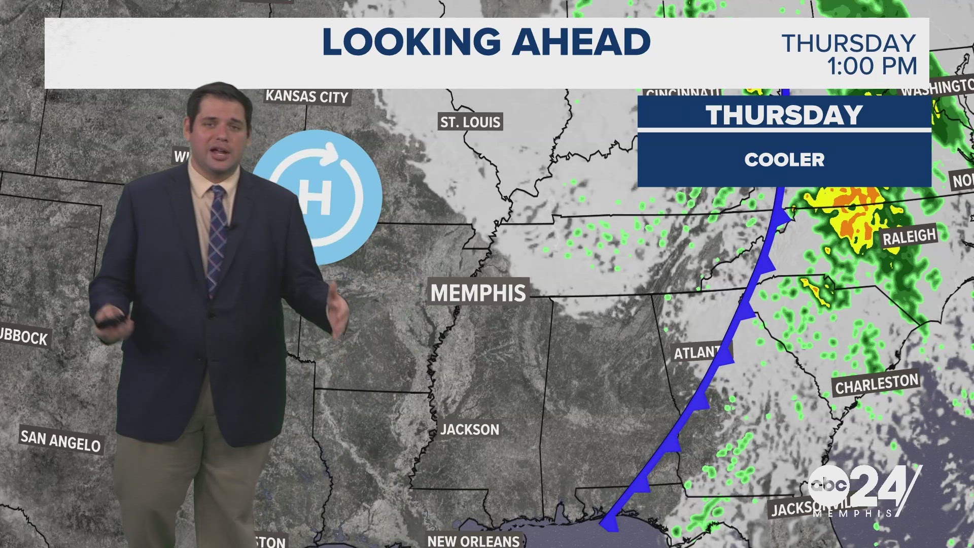
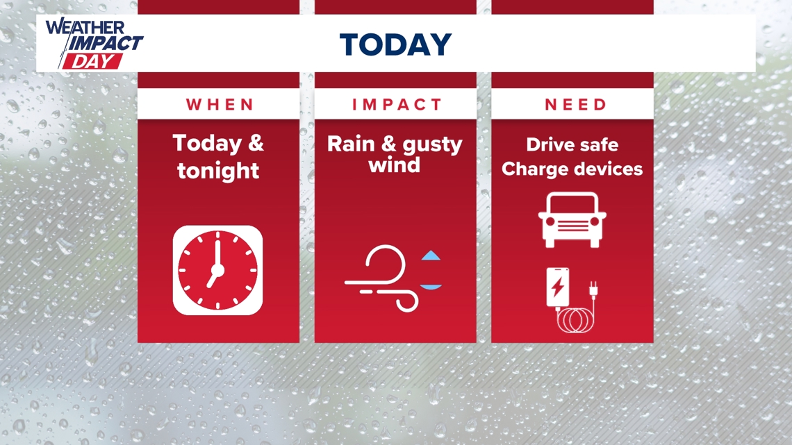
The remnants of Hurricane Helene will bring rain and gusty wind to the Memphis area for much of the day Friday into Friday night.

When will the rain arrive?
Rain will begin early Friday morning and continue all day Friday into Friday night. Most of the steady rain will end by Saturday morning, but a few light spotty showers are possible throughout the day Saturday.
How much rain can we expect?
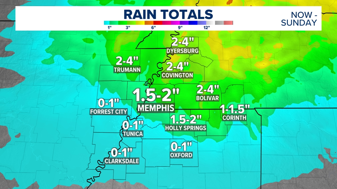
Many areas can expect around an inch or two of rain through Saturday. North of I-40, rain totals could be slightly higher, with amounts up to 3 or 4 inches closer to Dyersburg.

What will the winds be like?
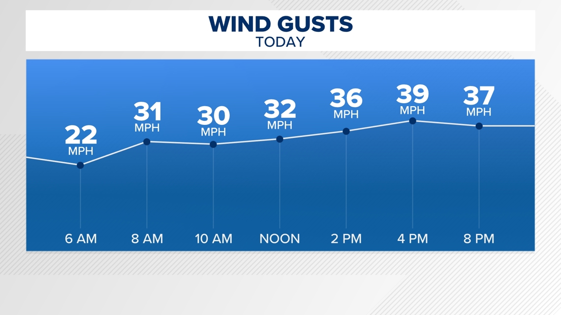
As the rain moves through the Mid-South, winds could gust up to 35 or 40 mph especially this evening and tonight.

Live Hurricane Helene Tracker
For the latest Memphis-area forecast anytime, visit abc24.com/weather.
The Associated Press contributed to this report.