

MEMPHIS, Tenn — Hurricane Francine made landfall Wednesday in Louisiana as a category 2 hurricane, bringing high wind, heavy rain, and storm surge to coastal areas.
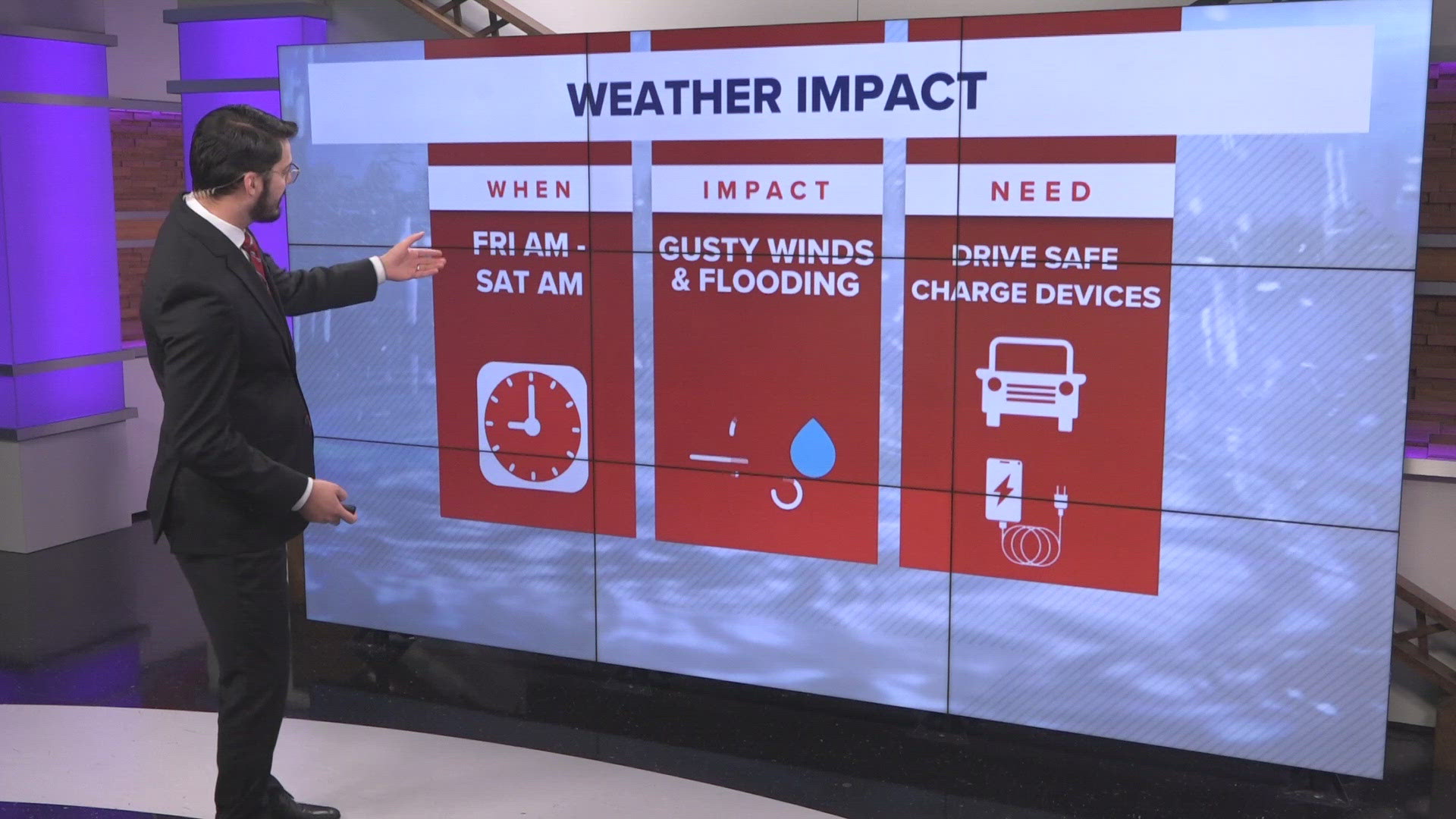
Francine is now moving further inland, bringing impacts to Memphis and the Mid-South today as the storm continues to weaken.
Heavy rain potential
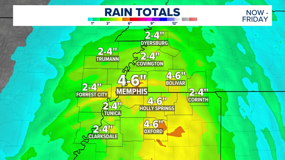
The biggest threat from Francine in the Memphis area will likely be the heavy rain. Showers will continue through the day Thursday and Thursday night, and the rain could be heavy at times. Showers are also possible into portions of Friday as well. In total, many neighborhoods will pick up 2 to 4 inches of rain, but some areas could see up to 5 or 6 inches.
That rain will help our serious drought condition, but since the ground is so dry, rain won't be able to soak into the ground as easily, which could lead to flash flooding concerns in parts of the Mid-South.

High wind gusts possible
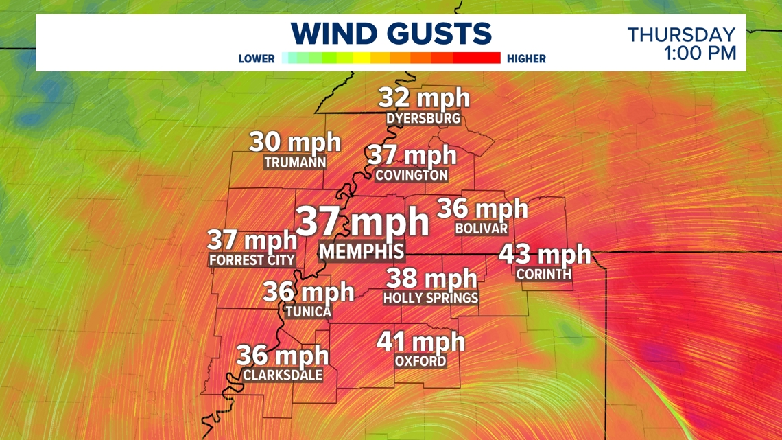
Francine will bring gusty winds to the Memphis area Thursday and Thursday night. Wind gusts will likely be up to 40 mph through the day Thursday, but there could be a few gusts as high as 50 or 55 mph. That could cause branches to fall and could possibly lead to sporadic power outages.

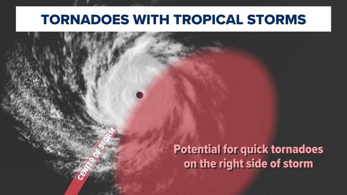
Tornado threat
As with any landfalling tropical system, the storm could spin up quick tornadoes as it moves further inland. Tornadoes are more likely on the right side of the storm track, which would keep the highest tornado threat closer to the Alabama state line and away from Memphis.

While the heaviest of the rain and the highest wind gusts will start to wrap up by 10 pm tonight, lighter rain showers will continue off-and-on tonight into Friday.
For the extended forecast, visit abc24.com/weather.